onX Hunt
-
4.9
-
Developer
onXmaps
-
Category
Sport
-
Version
22.14.3
-
Android OS
4.4
-
Downloads
810M
-
Content rating
0
Pro
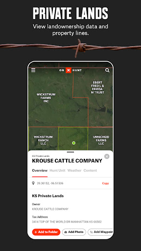
👍 onX Hunt delivers industry-leading property and boundary data, clearly showing public vs. private land, parcel lines, and ownership info. Hunters can quickly confirm access, avoid trespass, and plan legal entry points using reliable, up-to-date maps—reducing guesswork and improving safety and landowner relations during scouting and fieldwork.
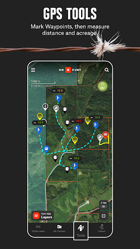
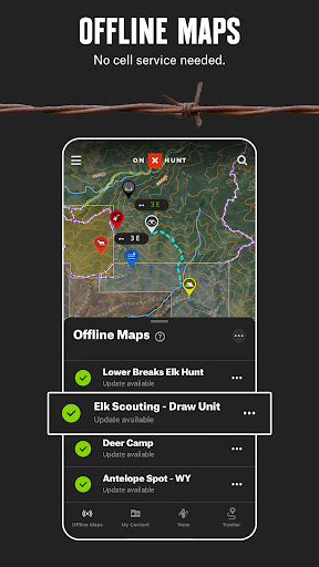
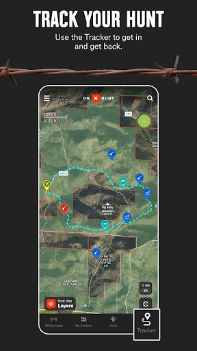
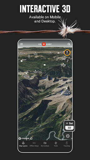
👍 Robust offline GPS mapping keeps you oriented where cell service fails. Download high-resolution satellite, topo, and hybrid maps, track routes, drop waypoints, and view your real-time location with meter-level accuracy. This dependable navigation suite simplifies backcountry travel, route planning, and retrieval of gear or game in remote hunting areas.
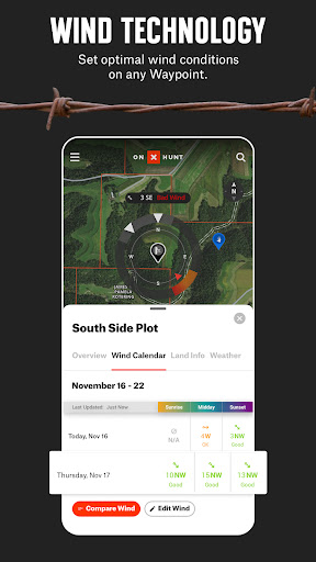
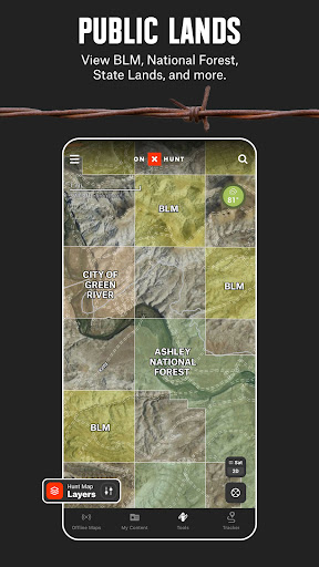
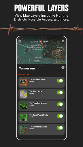
👍 Built for hunters, onX Hunt includes game management units, public-land overlays, season/regulation layers, wind and weather tools, and sharable waypoints. Use stand scouting, hunt planning, and harvest-tracking features to optimize stand placement, coordinate with partners, and document outings—streamlining preparation and improving success while adhering to local rules.
Con
👎 onX Hunt offers powerful GPS hunting maps, but full access requires a paid subscription. Annual or monthly fees and state or regional map add-ons can get expensive for casual hunters. Limited free features mean many useful layers (ownership, topo, public/private lands) remain behind a paywall.
👎 Continuous GPS tracking drains phone battery quickly, limiting long hunts without external power. High-resolution map tiles and pre-downloaded offline packs consume substantial storage and take time to prepare. In areas with poor reception, map loading and syncing can be slow or incomplete, reducing reliability in remote locations.
👎 Property boundaries, landowner names, and access layers are compiled from public records and third-party sources; they can be outdated, incomplete, or approximate. onX disclaims legal accuracy, so relying solely on the app can risk trespassing or incorrect access decisions — users must verify boundaries with official county records.
Screenshots